Current hours: 10:30am to 5pm Tuesday through Saturday. We are closed Sundays and Mondays for the Winter. IMPORTANT PLEASE NOTE: We have become aware that some of our photos have been stolen by other websites. Our maps are only available at our website www.mapsofantiquity.com or at our store!

Genuine Antique Nautical Sailing Chart-Untitled Cape Fear to St. Augustine Coast-1832-Hooker/Blunt-Maps-Of-Antiquity
  • Load image into Gallery viewer, Genuine Antique Nautical Sailing Chart-Untitled Cape Fear to St. Augustine Coast-1832-Hooker/Blunt-Maps-Of-Antiquity
  • Load image into Gallery viewer, Genuine Antique Nautical Sailing Chart-Untitled Cape Fear to St. Augustine Coast-1832-Hooker/Blunt-Maps-Of-Antiquity
  • Load image into Gallery viewer, Genuine Antique Nautical Sailing Chart-Untitled Cape Fear to St. Augustine Coast-1832-Hooker/Blunt-Maps-Of-Antiquity
  • Load image into Gallery viewer, Genuine Antique Nautical Sailing Chart-Untitled Cape Fear to St. Augustine Coast-1832-Hooker/Blunt-Maps-Of-Antiquity
  • Load image into Gallery viewer, Genuine Antique Nautical Sailing Chart-Untitled Cape Fear to St. Augustine Coast-1832-Hooker/Blunt-Maps-Of-Antiquity
  • Load image into Gallery viewer, Genuine Antique Nautical Sailing Chart-Untitled Cape Fear to St. Augustine Coast-1832-Hooker/Blunt-Maps-Of-Antiquity
  • Load image into Gallery viewer, Genuine Antique Nautical Sailing Chart-Untitled Cape Fear to St. Augustine Coast-1832-Hooker/Blunt-Maps-Of-Antiquity
  • Load image into Gallery viewer, Genuine Antique Nautical Sailing Chart-Untitled Cape Fear to St. Augustine Coast-1832-Hooker/Blunt-Maps-Of-Antiquity

1832 - Untitled: Cape Fear to St. Augustine Coast - Antique Chart

Regular price
$1,200.00
Sale price
$1,200.00
Regular price
Sold out
Unit price
per 
Shipping calculated at checkout.

Item number: CSMT129
Genuine Antique Nautical Chart

1832

Maker: Hooker / Blunt.


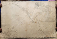
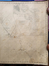
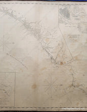
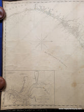
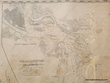
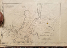
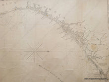
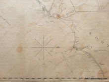
Antique blueback nautical chart by William Hooker and E. & G.W. Blunt showing the coast of North Carolina, South Carolina, Georgia, and part of Florida.  Includes Hilton Head, Jekyll Island, St. Simon, Cumberland, Sapelo, plus insets of Charleston and the entrance to St. John's River. This chart is oriented with north to the right, as indicated on the two compasses. It includes water depths near the shore, some cities such as St Augustine, Savannah, Charleston, and Wilmington NC. Hilton Head is labeled Trench's Island. About 25 1/2 x 37 inches. Fair to good antique condition with signs of age typical for a working sailing chart that was used at sea. Its is whole and the edges are in good condition. It has some stains and wrinkles. Could be restored for an additional cost. **NOTE- because this map requires extra insurance for shipping, which is why the shipping cost is higher than other items. If you would like it shipped without insurance, please contact us.**


Item Number: CSMT129