CLOSED THURSDAY MARCH 27th! SORRY FOR ANY INCONVENIENCE! Current hours: 10am to 5pm Tuesday through Saturday. We are closed Sundays and Mondays for the Winter. Proud to be a SMALL, LOCAL, CAPE COD BUSINESS! Maps of Antiquity is in its 38th year! Our maps are only available at our website www.mapsofantiquity.com or at our store!

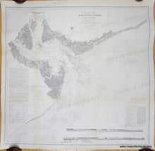
1856 - Preliminary Chart of Charleston Harbor And It's Approaches (South Carolina)- Antique Chart
  • Load image into Gallery viewer, 1856 - Preliminary Chart of Charleston Harbor And It's Approaches (South Carolina)- Antique Chart
  • Load image into Gallery viewer, 1856 - Preliminary Chart of Charleston Harbor And It's Approaches (South Carolina)- Antique Chart
  • Load image into Gallery viewer, 1856 - Preliminary Chart of Charleston Harbor And It's Approaches (South Carolina)- Antique Chart
  • Load image into Gallery viewer, 1856 - Preliminary Chart of Charleston Harbor And It's Approaches (South Carolina)- Antique Chart

1856 - Preliminary Chart of Charleston Harbor And It's Approaches (South Carolina)- Antique Chart

Regular price
$350.00
Sale price
$350.00
Regular price
Sold out
Unit price
per 
Shipping calculated at checkout.
 More payment options

Pickup available at 1409 MAIN ST, CHATHAM MA

Usually ready in 24 hours

Item number: SOU017

Genuine Antique Nautical Chart

1856

Maker: U.S. Coast Survey.


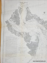
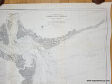
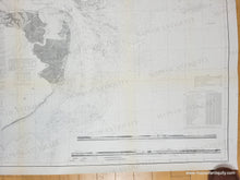
Antique coast chart of Charleston, SC published by the US Coast Survey in 1856. Shows some topography along the coast, the city streets, and water depths. Includes the City of Charleston, Hog, Drum, Folly, James, and Sullivan Islands, surrounding channels, two recognition profiles at the bottom, and text with sailing directions, buoy and beacon information, and tide and current charts. Measures approx. 30 1/4"h x 32"w to the neatline. Very good restored condition. This chart has been archivally cleaned and backed with light-weight paper. It retains some minor signs of age including slight toning along the folds (these were flattened during restoration), some wrinkles, and some waviness of the paper. Could be hand-colored by our professional colorist for an additional cost.

Genuine Antique Chart from 1856

Item Number: SOU017