1853
Maker: U.S. Coast Survey.
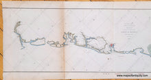
Antique coastal report chart of part of the coast of South Carolina, includes Savannah, Hilton Head Island (labeled Trench's Island on this map), Bulls Bay, Georgetown, and Charleston, etc. Published by the U.S. Coast Survey in 1853. Hand-coloring is recent. With folds, as issued. Good to very good overall antique condition with mild toning, some small spots, a repaired separation along one of the folds, wrinkling of the paper. Left neatline is lost. Toning slightly darker on left section. Measures approximately 8.5" x 32" (H x W) to the neatline.
Item Number: SOU159


