Current hours: 10:30am to 5pm Tuesday through Saturday. We are closed Sundays and Mondays for the Winter. IMPORTANT PLEASE NOTE: We have become aware that some of our photos have been stolen by other websites. Our maps are only available at our website www.mapsofantiquity.com or at our store!

Genuine-Antique-Nautical-Chart-Western-Pacific---Indonesia-Philippines-China-Japan-Chart-No-3-1864-Imray--Son-Maps-Of-Antiquity
  • Load image into Gallery viewer, Genuine-Antique-Nautical-Chart-Western-Pacific---Indonesia-Philippines-China-Japan-Chart-No-3-1864-Imray--Son-Maps-Of-Antiquity
  • Load image into Gallery viewer, Genuine-Antique-Nautical-Chart-Western-Pacific---Indonesia-Philippines-China-Japan-Chart-No-3-1864-Imray--Son-Maps-Of-Antiquity
  • Load image into Gallery viewer, Genuine-Antique-Nautical-Chart-Western-Pacific---Indonesia-Philippines-China-Japan-Chart-No-3-1864-Imray--Son-Maps-Of-Antiquity
  • Load image into Gallery viewer, Genuine-Antique-Nautical-Chart-Western-Pacific---Indonesia-Philippines-China-Japan-Chart-No-3-1864-Imray--Son-Maps-Of-Antiquity
  • Load image into Gallery viewer, Genuine-Antique-Nautical-Chart-Western-Pacific---Indonesia-Philippines-China-Japan-Chart-No-3-1864-Imray--Son-Maps-Of-Antiquity
  • Load image into Gallery viewer, Genuine-Antique-Nautical-Chart-Western-Pacific---Indonesia-Philippines-China-Japan-Chart-No-3-1864-Imray--Son-Maps-Of-Antiquity

1864 - Western Pacific - Australia to China, Chart No. 3 - Antique Map

Regular price
$1,500.00
Sale price
$1,500.00
Regular price
Sold out
Unit price
per 
Shipping calculated at checkout.

Item number: NAU426
Genuine Antique Nautical Chart

1864

Maker: Imray & Son


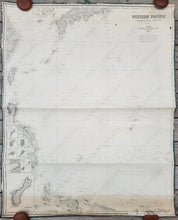
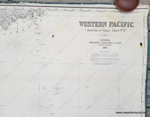
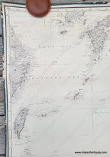
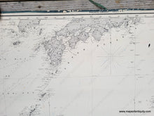
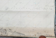
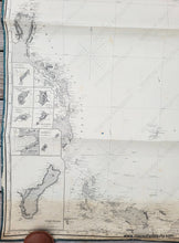
Antique "blue back" nautical chart of part of the western Pacific Ocean published by James Imray & Son in 1864. This impressive chart covers the area from Papua New Guinea (this portion is now part of Indonesia) to Japan (up to Yokohama) and includes part of the Philippines, Taiwan or Formosa, and part of the coast of China with Shanghai and Ningbo. With eight inset maps of smaller islands including Guam. A spectacular chart of a part of the world that fascinated Europeans at this time, just a few years after Japan opened to trading with Europeans. Good anique condition with some horizontal creases, some vertical wrinkles that are common on antique charts, some minor stains, a small tear at the bottom, some minor surface soil. There are two small holes at top and the blue backing paper shows through in a few places where the surface has worn. hand written plotting. This chart was bound at the edges with fabric, which has protected the edges of the chart, but some of the fabric has worn away. Measures approx. 49h x 40w inches to the neatline (slightly larger to the edges). **NOTE- this map requires extra insurance for shipping. Please contact us if you have any questions about the shipping or cost of shipping.**


Item Number: NAU426