Winter hours: Tuesday - Saturday 10am to 5pm. Close Sundays and Mondays until May. We appreciate your business!

Antique-Hand-Colored-Map-Plan-of-Boston-Comprising-a-part-of-Charlestown-and-Cambridge-Massachusetts-Towns-and-Cities-1851-George-Smith-Maps-Of-Antiquity
1853 - Plan of Boston, Comprising a part of Charlestown and Cambridge - Antique Map
  • Load image into Gallery viewer, Antique-Hand-Colored-Map-Plan-of-Boston-Comprising-a-part-of-Charlestown-and-Cambridge-Massachusetts-Towns-and-Cities-1851-George-Smith-Maps-Of-Antiquity
  • Load image into Gallery viewer, 1853 - Plan of Boston, Comprising a part of Charlestown and Cambridge - Antique Map
  • Load image into Gallery viewer, 1853 - Plan of Boston, Comprising a part of Charlestown and Cambridge - Antique Map
  • Load image into Gallery viewer, 1853 - Plan of Boston, Comprising a part of Charlestown and Cambridge - Antique Map
  • Load image into Gallery viewer, 1853 - Plan of Boston, Comprising a part of Charlestown and Cambridge - Antique Map
  • Load image into Gallery viewer, 1853 - Plan of Boston, Comprising a part of Charlestown and Cambridge - Antique Map
  • Load image into Gallery viewer, 1853 - Plan of Boston, Comprising a part of Charlestown and Cambridge - Antique Map

1853 - Plan of Boston, Comprising a part of Charlestown and Cambridge - Antique Map

Regular price
$550.00
Sale price
$550.00
Regular price
Sold out
Unit price
per 
Shipping calculated at checkout.

Item number: MAS2311
Genuine Antique Hand-Colored Map

1853

Maker: George Smith.

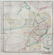
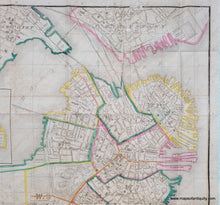
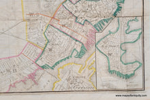
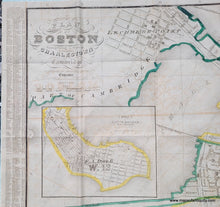
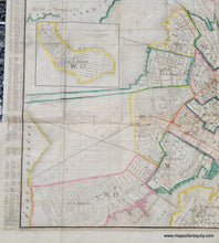
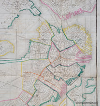
Antique hand-colored map of Boston, and parts of Charlestown and Cambridge, by George Smith, published in the Municipal Register for the City of Boston in 1853. With insets of South Boston and East Boston. The harbor waters reach right up to Quincy Market where the wharves were later filled in. The index on the left side shows streets, streets, places, courts, avenues, lanes, squares, alleys, churches, hotels, and public buildings.

This map shows Boston at a fascinating moment in the city's history: the Mill Dam was in operation and additional plans for what is now Back Bay (labeled Receiving Basin on the map) had not yet been conceived. In 1814, the Boston and Roxbury Mill Corporation was chartered to construct a mill dam, which would also serve as a toll road connecting Boston to Watertown, bypassing Boston Neck. The dam prevented the natural tides from flushing sewage out to sea, creating severe sanitary and odor problems. With costs higher and power lower than expected, in the end, the project was an economic failure, and in 1857 a massive project was begun to "make land" by filling the area enclosed by the dam. Present-day Back Bay itself was filled by 1882; the project reached existing land at what is now Kenmore Square in 1890, and finished in the Fens in 1900.

Very good overall antique condition, with folds as issued, mild image transfer from being folded. Some wear/tiny tears at the fold intersections. Measures approx. 21 x 20.25 inches to the neatline. 

Item Number: MAS2311