Item number: MAS2433
Genuine Antique Map
1895
Maker: Stadley / AMC
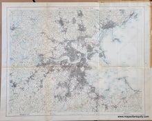
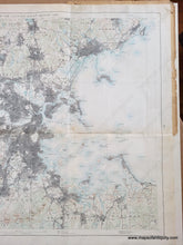
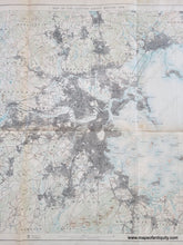
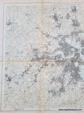
Antique map of the vicinity of Boston, Massachusetts, prepared for the Metropolitan Park Commission, under the direction of Olmsted, Olmsted and Eliot, by Geo. W. Stadley & Co. and published with permission by the Appalachian Mountain Club. Olmsted drew the first studies for his Boston Park Department commission in the summer of 1878, and completed his final plans in 1895. In addition to the Arnold Arboretum, Olmsted designed the series of Boston’s parks from the Public Garden to Franklin Park with connecting parkways, known today as the Emerald Necklace. The Olmsted firm undertook additional design work between 1890 and 1895 in order to accommodate the acquisition of Peters Hill, the highest point in the Arnold Arboretum. In later versions of this map, the Public Reservations such as the Blue Hills Reservation and the Middlesex Fells Reservation were printed with a dark green color, but their appearance is more subtle on this earlier version. This map shows topography and population density, with the many towns and villages around Boston labeled. Cohasset to Marblehead and Dover to Concord with a nice depiction of Boston Harbor. This map was folded and retains its folds. At some point it was put in a scrapbook of some kind and it has a page of newspaper clippings attached on the back of the upper right corner. Very good condition with minor waviness of the antique paper, and some very mild stains (such as the one south of Winthrop). Measures approx. 23 x 29 inches to the neatline.
Item Number: MAS2433


