Pickup available at 1409 MAIN ST, CHATHAM MA
Usually ready in 24 hours
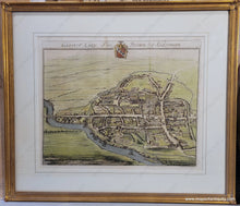
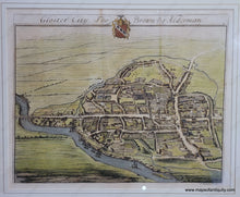
1712 circa - Gloster City, Tho. Brown Esq. Alderman - Antique Map
-
1409 MAIN ST, CHATHAM MA
Pickup available, usually ready in 24 hours1409 Main Street
Chatham MA 02633
United States+15089451660
c. 1712-1724
Maker: Kip
Antique hand-colored map of Gloucester in Gloucestershire, near the Cotswolds, England. By Johannes Kip, this map was first published in "The Ancient & Present State of Gloucestershire", in 1712 and issued again in the 1724 Nouveau Theatre de la Grande Bretagne. We believe this map to have been part of the former publication. This handsome bird's-eye view shows the city streets and the recognizable Gloucester Cathedral. It features hand-coloring and is nicely framed. Can be purchased unframed at same price. Frame is in good condition with minor wear. Map is in very good antique condition with some mild spots/staining. Print measures approx. 13.5 x 17 inches to the neatline. Overall dimensions are 21.5 x 25 inches
Item Number: TOW770


