Current hours: 10am to 5pm Monday through Saturday. 12pm to 5pm Sundays. IMPORTANT PLEASE NOTE: We have become aware that some of our photos have been stolen by other websites. Our maps are only available at our website www.mapsofantiquity.com or at our store!

1896 - Boston and Maine Railroad  and Controlled Lines- Antique Map
  • Load image into Gallery viewer, 1896 - Boston and Maine Railroad  and Controlled Lines- Antique Map
  • Load image into Gallery viewer, 1896 - Boston and Maine Railroad  and Controlled Lines- Antique Map
  • Load image into Gallery viewer, 1896 - Boston and Maine Railroad  and Controlled Lines- Antique Map
  • Load image into Gallery viewer, 1896 - Boston and Maine Railroad  and Controlled Lines- Antique Map

1896 - Boston and Maine Railroad and Controlled Lines- Antique Map

Regular price
$85.00
Sale price
$85.00
Regular price
Sold out
Unit price
per 
Shipping calculated at checkout.

Item number: NEW209

Genuine Antique Book with Map

1896

Maker: Boston & Maine Railroad


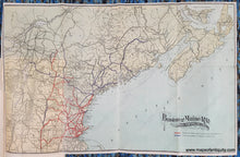
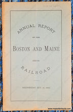
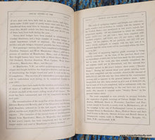
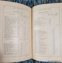
Antique report booklet with map, published by the Boston & Maine Railroad, 1896. Booklet title "Annual Report of the Boston and Maine Railroad 1895-96" This printed-color map of New England shows the route of the Boston and Maine Railroad, covering Massachusetts, Vermont, New Hampshire, and Maine with red indicating Boston & Maine and Leased Lines operated by it and blue showing Lines Controlled by Boston & Maine R.R. Delightful vintage typography of the title. Map is attached to the the book but can be separated. Good to very good antique condition with folds as issued and very minor wear along the folds. Small tear on left side. Booklet measures approx. 9.25 x 6 inches. Map measures approx. 13 x 20.5 inches to the neatline.


Item Number: NEW209