Current hours: 10am to 5pm Monday through Saturday. 12pm to 5pm Sundays. IMPORTANT PLEASE NOTE: We have become aware that some of our photos have been stolen by other websites. Our maps are only available at our website www.mapsofantiquity.com or at our store!

Antique-Printed-Book-with-Center-Map-and-many-additional-Maps-Aero-View-Map-showing-Territory-covered-by-the-Lines-of-the-Bay-State-Street-Railway-Co-and-their-Connections-**********-United-States-Massachusetts-1913-Bay-State-Street-Railway-Company-Maps-Of-Antiquity
  • Load image into Gallery viewer, Antique-Printed-Book-with-Center-Map-and-many-additional-Maps-Aero-View-Map-showing-Territory-covered-by-the-Lines-of-the-Bay-State-Street-Railway-Co-and-their-Connections-**********-United-States-Massachusetts-1913-Bay-State-Street-Railway-Company-Maps-Of-Antiquity
  • Load image into Gallery viewer, Antique-Printed-Book-with-Center-Map-and-many-additional-Maps-Aero-View-Map-showing-Territory-covered-by-the-Lines-of-the-Bay-State-Street-Railway-Co-and-their-Connections-**********-United-States-Massachusetts-1913-Bay-State-Street-Railway-Company-Maps-Of-Antiquity
  • Load image into Gallery viewer, Antique-Printed-Book-with-Center-Map-and-many-additional-Maps-Aero-View-Map-showing-Territory-covered-by-the-Lines-of-the-Bay-State-Street-Railway-Co-and-their-Connections-**********-United-States-Massachusetts-1913-Bay-State-Street-Railway-Company-Maps-Of-Antiquity
  • Load image into Gallery viewer, Antique-Printed-Book-with-Center-Map-and-many-additional-Maps-Aero-View-Map-showing-Territory-covered-by-the-Lines-of-the-Bay-State-Street-Railway-Co-and-their-Connections-**********-United-States-Massachusetts-1913-Bay-State-Street-Railway-Company-Maps-Of-Antiquity

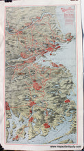
1913 - Aero View Map showing Territory covered by the Lines of the Bay State Street Railway Co and their Connections - Antique Map

Regular price
$125.00
Sale price
$125.00
Regular price
Sold out
Unit price
per 
Shipping calculated at checkout.

Item number: MAS1740
Genuine Antique Printed Book with Center Map and many additional Maps

1913

Maker: Bay State Street Railway Company.


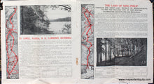
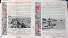
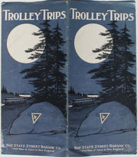
Antique trolley guide for eastern Massachusetts, the map was issued by the Passenger Department and copyright Bay State Street Railway Co. 1912. The booklet is titled Trolley Trips and was published in 1913. This travel guide offers travelers information about the trolley service, shown on the map in red, that connected many parts of the state. This map is the center page in a folded booklet published for travelers. It includes a lot of travel information with further maps and images. Very good condition with mild toning and rusted staples at center fold. The map measures approx. 15.25 x 8 inches to the neatline. When the book is folded, it measures 9 x 4.25 inches  


Item Number: MAS1740