1876
Maker: Reading Publishing House
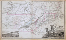
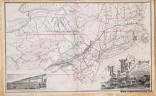
Antique hand colored map of part of the Northeast published by Reading Publishing House, 1876. This map shows Pennsylvania, New York, New Jersey, Connecticut, Rhode Island, part of Massachusetts, and the southern portions of the other New England states. Full title is: "Map of the South Mountain and Boston Rail Road Connections showing Territory passed through, Rail-roads and Canals Crossed or connected with, Together with Mineral and Geographical Features of Country Passed through." Includes illustrations of the Bridge by which the South Mountain and Boston R.R. is to cross the Hudson River at Poughkeepsie, N.Y. and a SM&B.RR. train. Good antique condition with some spots and soiling, some small tears. Measures approx. 16 x 26.5 inches.
Item Number: USA407


