Current hours: 10am to 5pm Tuesday through Saturday. We are closed Sundays and Mondays for the Winter. IMPORTANT PLEASE NOTE: We have become aware that some of our photos have been stolen by other websites. Our maps are only available at our website www.mapsofantiquity.com or at our store!

Genuine-Antique-Map-Map-of-the-Railroads-in-the-United-States-in-Operation-and-Progress-1853-Israel-D-Andrews-Maps-Of-Antiquity
1853 - Map Of The Railroads In United States Operation And Progress Antique Genuine
  • Load image into Gallery viewer, Genuine-Antique-Map-Map-of-the-Railroads-in-the-United-States-in-Operation-and-Progress-1853-Israel-D-Andrews-Maps-Of-Antiquity
  • Load image into Gallery viewer, 1853 - Map Of The Railroads In United States Operation And Progress Antique Genuine
  • Load image into Gallery viewer, 1853 - Map Of The Railroads In United States Operation And Progress Antique Genuine
  • Load image into Gallery viewer, 1853 - Map Of The Railroads In United States Operation And Progress Antique Genuine
  • Load image into Gallery viewer, 1853 - Map Of The Railroads In United States Operation And Progress Antique Genuine
  • Load image into Gallery viewer, 1853 - Map Of The Railroads In United States Operation And Progress Antique Genuine
  • Load image into Gallery viewer, 1853 - Map Of The Railroads In United States Operation And Progress Antique Genuine

1853 - Map of the Railroads in the United States in Operation and Progress - Antique Map

Regular price
$750.00
Sale price
$750.00
Regular price
Sold out
Unit price
per 
Shipping calculated at checkout.

Item number: USA440
Genuine Antique Map

1853

Maker: Israel D. Andrews

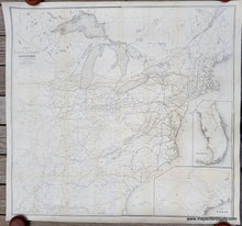
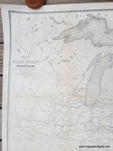
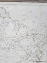
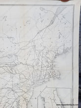
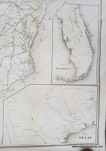
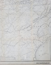
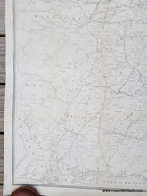
Impressive antique map of the railroads of the United States as of 1853. This was created to accompany a report from the Treasury Department by Israel D. Andrews, drawn and engraved under the direction of the Editor of the American Rail Road Journal, engraved by Ackerman. This map covers the area from Maine to Minnesota in the North and Florida to Louisiana in the South. Most of Florida is shown in an inset, as is part of Texas. At the time of this map, Texas, Iowa, and Wisconsin were new states and the transcontinental railroad, constructed between 1863 and 1869, was perhaps only a dream. This map is made from four joined sheets, all of which had been folded into a book for publication. Very good restored condition, with some very light toning along the former fold lines, and areas where the printing is slightly lighter. This map has been archivally cleaned and backed on fabric. Measures approx. 39 x 42 inches to the neatline.

Item Number: USA440