1898
Maker: Cram.
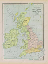
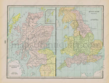
Antique printed color map of the Anglo-Saxon and Celtic Kingdoms in the British Isles (around 457-1066 A.D.) on Recto. This map is colored (with a key) to show the boundaries between the Angle or Engle Kingdoms, Saxon Kingdoms, Jute Kingdoms, Scandinavian Kingdoms, and the Celtic Kingdoms. On verso: Conjoined maps showing England and Scotland during the "Saxon Period." Very good overall antique condition with some slight overall toning. By Cram, 1898, original atlas unknown. Recto map (Anglo-Saxon & Celtic) measures approximately 12.5" x 9" (H x W) to the neatline. Verso maps (Scotland & England) together measure approximately 9.5" x 12.5" to the neatline.
Item Number: EUR1927


