
Item number: USA164
Genuine Antique Hand Colored Map
1868
Maker: Mitchell
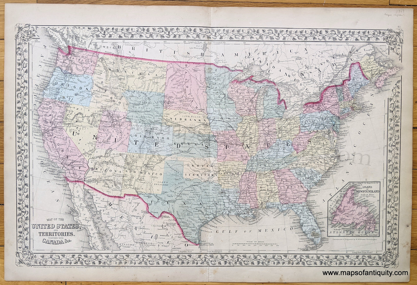
Antique hand colored map of the United States, copyrighted 1867 and published by S. Augustus Mitchell in his 1868 atlas, with states and territories delineated by color, with "Dacotah" absorbing both present-day Dakotas. This map is pre-Yellowstone park, and in fact Wyoming (with an unusual shape) says "Attached to Dacotah." Includes inset of the Island of Newfoundland, and showing detail of cities and towns, water bodies, roads, railroads, and many interesting notations regarding Native American tribes. Good condition with toning, some stains in the margins, and archivally repaired seam separation at bottom. Measures 13.25 x 21.25 inches to the outer edge of the decorative border.
Item Number: USA164