1720
Maker: Homann
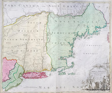
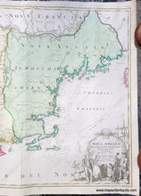
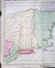
Handsome early antique map of New England, by the German cartographer Homann, c. 1720, showing the spread of the English colonies throughout New England, New York, and New Jersey. This map shows early interpretations of Long Island, Cape Cod and the Islands, and Lake Champlain, among other areas, with Native American Indian tribes, forts, topography and some bathymetry, particularly relating to known shoals along the coast. Interesting geographical abberations include Cape Cod split in pieces, Cape Ann shown distinctly as an island, East and West New Jersey shown clearly, a rather round Lake Champlain that is on the wrong side of the Connecticut River, and some unusual lakes in the west. An elaborate cartouche shows an Englishman with a fox pelt he has presumably just received from a Native American in trade for some of the continental riches arrayed at the Englishman's feet. Very good condition, with some tiny spots and other minor signs of age. May have been cleaned or restored by a previous owner. Measures approx. 19 x 22.75 inches to the neatline.
Item Number: CSMT118


