Current hours: 10am to 5pm Monday through Saturday. 12pm to 5pm Sundays. We are CLOSED on Christmas Day and New Years Day. We will close early (3pm) on Christmas Eve. IMPORTANT PLEASE NOTE: We have become aware that some of our photos have been stolen by other websites. Our maps are only available at our website www.mapsofantiquity.com or at our store!

Genuine-Antique-Nautical-Chart-Blunt's-New-Chart-of-the-West-Indies-and-the-Gulf-of-Mexico-1832-1837-Blunt-Maps-Of-Antiquity
1832/1837 - Blunt’s New Chart Of The West Indies And Gulf Mexico Antique Map Genuine Nautical
  • Load image into Gallery viewer, Genuine-Antique-Nautical-Chart-Blunt's-New-Chart-of-the-West-Indies-and-the-Gulf-of-Mexico-1832-1837-Blunt-Maps-Of-Antiquity
  • Load image into Gallery viewer, 1832/1837 - Blunt’s New Chart Of The West Indies And Gulf Mexico Antique Map Genuine Nautical
  • Load image into Gallery viewer, 1832/1837 - Blunt’s New Chart Of The West Indies And Gulf Mexico Antique Map Genuine Nautical
  • Load image into Gallery viewer, 1832/1837 - Blunt’s New Chart Of The West Indies And Gulf Mexico Antique Map Genuine Nautical
  • Load image into Gallery viewer, 1832/1837 - Blunt’s New Chart Of The West Indies And Gulf Mexico Antique Map Genuine Nautical
  • Load image into Gallery viewer, 1832/1837 - Blunt’s New Chart Of The West Indies And Gulf Mexico Antique Map Genuine Nautical
  • Load image into Gallery viewer, 1832/1837 - Blunt’s New Chart Of The West Indies And Gulf Mexico Antique Map Genuine Nautical
  • Load image into Gallery viewer, 1832/1837 - Blunt’s New Chart Of The West Indies And Gulf Mexico Antique Map Genuine Nautical
  • Load image into Gallery viewer, 1832/1837 - Blunt’s New Chart Of The West Indies And Gulf Mexico Antique Map Genuine Nautical

1832/1837 - Blunt's New Chart of the West Indies and the Gulf of Mexico - Antique Map

Regular price
$8,000.00
Sale price
$8,000.00
Regular price
Sold out
Unit price
per 
Shipping calculated at checkout.

Item number: CSMT126
Genuine Antique Nautical Chart

1832/1837

Maker: Blunt

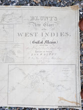
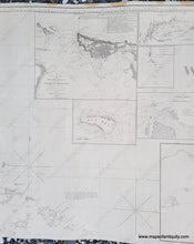
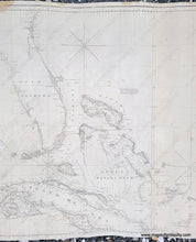
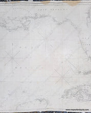
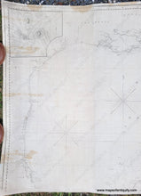
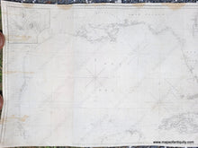
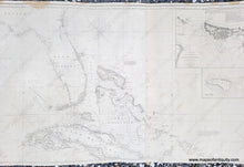
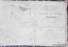
Excellent antique blueback chart of part of the Caribbean by E. and G.W. Blunt, first printed in 1832 with updates to 1837. This nautical chart shows all of the Bahamas, Florida (East and West), nearly all of Cuba, and the Texas and Mexico Gulf Coast south to Cape Rojo. There is a small section of the northern coast of the Yucatan. It includes seven inset maps: Tampico Bay 1833, Rum Key, Harbor Island of Puerto Rico, Harbor of Matanzas, Ragged Island, Entrance Harbor of Havanna, and Harbor of St. Thomas. This is a particularly interesting and important chart. The Blunts were the first serious and successful chart makers after the Revolution. This chart was privately made during the early years of the US Coast Survey. No charts had yet been made by the US Government, hence this was an important chart. There are interestingly 13 different fonts used in the long title of the chart. This is very similar to the fancier charts made in Europe by Heather and to my knowledge not used on other American charts. Very good restored condition, cleaned and rebacked, with some signs of age remaining including minor repaired tears and some mild stains. Measures approx. 25 x 82.5 inches to the neatline.

Item Number: CSMT126