Current hours: 10am to 5pm Monday through Saturday. 12pm to 5pm Sundays. IMPORTANT PLEASE NOTE: We have become aware that some of our photos have been stolen by other websites. Our maps are only available at our website www.mapsofantiquity.com or at our store!

Antique-County-Map-of-the-State-of-California-Mitchell-1864-1860s-1800s-Mid-Late-19th-Century-Maps-of-Antiquity
1864 - County Map Of The State California Antique Genuine Hand-Colored
  • Load image into Gallery viewer, Antique-County-Map-of-the-State-of-California-Mitchell-1864-1860s-1800s-Mid-Late-19th-Century-Maps-of-Antiquity
  • Load image into Gallery viewer, 1864 - County Map Of The State California Antique Genuine Hand-Colored
  • Load image into Gallery viewer, 1864 - County Map Of The State California Antique Genuine Hand-Colored

1864 - County Map of the State of California - Antique Map

Regular price
$195.00
Sale price
$195.00
Regular price
Sold out
Unit price
per 
Shipping calculated at checkout.

Item number: WES162
Genuine Antique Hand Colored Map

1864

Maker: Mitchell.

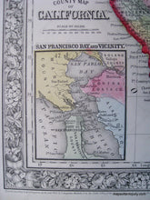
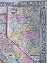
This antique hand colored map was published in 1864 by the S. Augustus Mitchell Co. Each county in the state is colored separately with original hand coloring. Cities, towns, railroad lines and geographical features are shown. In the upper right corner there is an inset map of the Settlements in the Great Salt Lake Country, Utah. In the lower left corner there is a small inset map of the entire San Francisco Bay area. Decorative border has a lush floral pattern. This map is in good overall antique condition with some mild toning throughout, as well as a stain at the bottom of the page (mainly outside the border.) Map measures approximately 13" x 10.5" to the outer edges of the decorative border.

Item Number: WES162