Antique-Printed-Color-Map-Map-of-the-Main-Portion-of-Washington-D.-C.-Verso:-Virginia-1911-Rand-McNally-Mid-Atlantic-Washington-DC-Virginia-1800s-19th-century-Maps-of-Antiquity
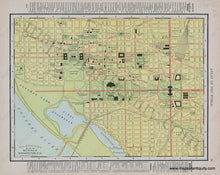
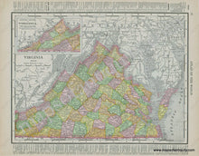
1911 - Map of the Main Portion of Washington D. C., Verso: Virginia - Antique Map
  • Load image into Gallery viewer, Antique-Printed-Color-Map-Map-of-the-Main-Portion-of-Washington-D.-C.-Verso:-Virginia-1911-Rand-McNally-Mid-Atlantic-Washington-DC-Virginia-1800s-19th-century-Maps-of-Antiquity
  • Load image into Gallery viewer, 1911 - Map of the Main Portion of Washington D. C., Verso: Virginia - Antique Map

1911 - Map of the Main Portion of Washington D. C., Verso: Virginia - Antique Map

Regular price
$95.00
Sale price
$95.00
Regular price
Sold out
Unit price
per 
Shipping calculated at checkout.

Item number: MAT264
Genuine Antique Printed Color Map

1911

Maker: Rand McNally.

Antique printed color map of Washington DC, showing names of major streets, railroads, points of interest, etc. (Recto.) On Verso: Map of Virginia, colored by county, showing railroads, topographical detail, etc. Good to Very good overall antique condition with mild toning throughout, and some minor roughing of the outer edges of the paper. Each map measures approximately 9.25" x 12.5" (H x W) to the neatline.

Item Number: MAT264