Current hours: 10am to 5pm Monday through Saturday. 12pm to 5pm Sundays. IMPORTANT PLEASE NOTE: We have become aware that some of our photos have been stolen by other websites. Our maps are only available at our website www.mapsofantiquity.com or at our store!

Genuine-Antique-Map-Military-Map-of-Nebraska-and-Dakota-1858-G.K.-Warren-Maps-Of-Antiquity
  • Load image into Gallery viewer, Genuine-Antique-Map-Military-Map-of-Nebraska-and-Dakota-1858-G.K.-Warren-Maps-Of-Antiquity
  • Load image into Gallery viewer, Genuine-Antique-Map-Military-Map-of-Nebraska-and-Dakota-1858-G.K.-Warren-Maps-Of-Antiquity
  • Load image into Gallery viewer, Genuine-Antique-Map-Military-Map-of-Nebraska-and-Dakota-1858-G.K.-Warren-Maps-Of-Antiquity
  • Load image into Gallery viewer, Genuine-Antique-Map-Military-Map-of-Nebraska-and-Dakota-1858-G.K.-Warren-Maps-Of-Antiquity
  • Load image into Gallery viewer, Genuine-Antique-Map-Military-Map-of-Nebraska-and-Dakota-1858-G.K.-Warren-Maps-Of-Antiquity
  • Load image into Gallery viewer, Genuine-Antique-Map-Military-Map-of-Nebraska-and-Dakota-1858-G.K.-Warren-Maps-Of-Antiquity

1858 - Military Map of Nebraska and Dakota - Antique Map

Regular price
$2,800.00
Sale price
$2,800.00
Regular price
Sold out
Unit price
per 
Shipping calculated at checkout.

Item number: MWE508
Genuine Antique Map

1858

Maker: G.K. Warren


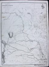
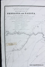
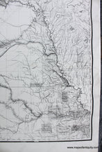
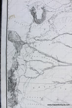
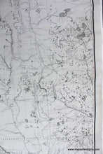
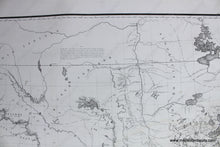
Antique map of Kansas, Nebraska, Dakota and part Colorado and Wyoming, based upon surveys and reconnaissance expeditions conducted between 1823 and 1857, by Gouverneur Kemble Warren. This is the first state of this map, c. 1858, which is  described by some as  "virtually unobtainable." It includes one of the earliest maps to reference the Gold Regions in part of Kansas Territory which would become Colorado Territory. The Gold Fields on Cherry Creek are shown on the first state of the map, with the second state of the map updated to add the place name "Auraria." This was one of the first gold rush settlements in this part of the Rockies, which is now the Denver area. This is the first state of the map, lacking the Auraria reference which would have appeared around 39.30 ° N, 105 ° W on the map. The second state also includes, to the right of the title, the words "Engraving Carefully Revised G.K. Warren Lieut. Top Engrs." With fantastic detail of Native American Indian Nations, forts, exploration routes, and more. This map has been well studied and additional information about it is available in many places on the internet. This map is almost never available on the market and it is an incredible find. It has been backed on linen. Some signs of age remain, including repaired tears and tape stain on the left side. Some waviness most noticeable at edges. Overall very good condition. Measures approx. 42.5 x 31.75 inches to the neatline and 45.75 x 33.75 inches to the sheet edges.  ***Note: this item will require additional insurance above what is included with the shipping as calculated by our website- we will send an invoice for the additional cost before shipping***


Item Number: MWE508