Current hours: 10am to 5pm Monday through Saturday. Closed on Sundays. IMPORTANT PLEASE NOTE: We have become aware that some of our photos have been stolen by other websites. Our maps are only available at our website www.mapsofantiquity.com or at our store!

Antique-Guide-Book-with-Printed-Color-Map-Tourist's-Handbook.-Colorado-Utah-and-New-Mexico-United-States-West-1904-Denver-Rio-Grande-Railroad-System-Maps-Of-Antiquity
1904 - Tourist's Handbook. Colorado, Utah, and New Mexico - Antique Map
  • Load image into Gallery viewer, Antique-Guide-Book-with-Printed-Color-Map-Tourist's-Handbook.-Colorado-Utah-and-New-Mexico-United-States-West-1904-Denver-Rio-Grande-Railroad-System-Maps-Of-Antiquity
  • Load image into Gallery viewer, 1904 - Tourist's Handbook. Colorado, Utah, and New Mexico - Antique Map
  • Load image into Gallery viewer, 1904 - Tourist's Handbook. Colorado, Utah, and New Mexico - Antique Map

1904 - Tourist's Handbook. Colorado, Utah, and New Mexico - Antique Map

Regular price
$95.00
Sale price
$95.00
Regular price
Sold out
Unit price
per 
Shipping calculated at checkout.

Item number: WES225
Genuine Antique Guide Book with Printed Color Map

1904

Maker: Denver Rio Grande Railroad System.

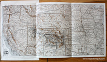
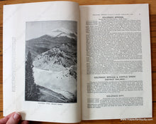
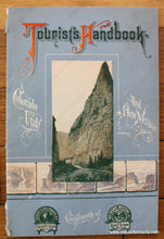
Antique travel guide for Colorado, Utah, and New Mexico, published in 1904 by the Denver & Rio Grande Railroad System. The book details the many parks, towns, monuments, and attractions along the railroad lines and includes a fold-out map at the back of the book. Includes many black-and-white images with a printed color cover and printed color map. Very good condition, entire guide book appears to be intact with wear at the binding but still together. Book measures approx. 9 x 6 inches and the fold-out map measures approx. 7.5 x 15.25 inches to the neatline.

Item Number: WES225