Genuine Antique Printed Color Map
1892
Maker: Home Library & Supply Association.
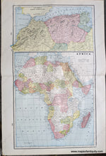
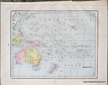
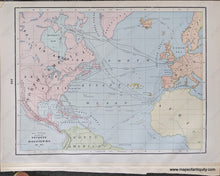
Antique printed color double-sided maps published in "The Pacific Coast and the World" by the Home Library and Supply Association, 1892. Centerfold map shows Africa with inset map of Northwest Africa, maps on the other sides of the sheet are Oceania on one side and a map of the North Atlantic showing voyages and discoveries on the other side. These maps show some topography, railroads, cities, and more. Very good overall antique condition with some very mild toning/foxing (mainly at the outer edges.) Centerfold map measures approximately 18.5 x 12" (H x W) to the neatline. Smaller maps on versos measure approx. 12 x 9" to the neatline.
Item Number: AFR265


