1917
Maker: Poole Brothers / Union Pacific System
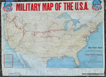
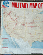
Antique printed color wall map copyrighted by the Poole Bros. and issued by the Union Pacific System in 1917, as the US was getting into World War 1. This map highlights the Union Pacific Railroad and connections, likely to gain public favor by aligning the company with the military and the war effort. The map shows Forts, Military Camps, National Guard Camps, Aero Training Stations, Naval Training Stations, Naval Yards, Naval Radio Stations, National Parks, as well as all other railroads in the country at the time. On metal rods. Good to very good condition, this map has been restored by a previous owner, with the damage on the left side repaired and some minor areas filled in. It retains some stains on the left side, some minor wrinkles, and some minor wear on the right edge. Some rusting on the left side of the rods.Measures approx. 18 x 32 inches to the neatline of the map and 24.5 x 33 inches overall.
Item Number: USA420


