Current hours: 10am to 5pm Tuesday through Saturday. We are closed Sundays and Mondays for the Winter. IMPORTANT PLEASE NOTE: We have become aware that some of our photos have been stolen by other websites. Our maps are only available at our website www.mapsofantiquity.com or at our store!

Antique-Printed-Color-Folding-Map-Pictorial-Map-Idaho-Montana-Wyoming-1947-Rand-McNally-/-Union-Oil-Company-West--1900s-20th-century-Maps-of-Antiquity
1947 - Pictorial Map Idaho Montana Wyoming Antique Genuine Printed-Color Folding
  • Load image into Gallery viewer, Antique-Printed-Color-Folding-Map-Pictorial-Map-Idaho-Montana-Wyoming-1947-Rand-McNally-/-Union-Oil-Company-West--1900s-20th-century-Maps-of-Antiquity
  • Load image into Gallery viewer, 1947 - Pictorial Map Idaho Montana Wyoming Antique Genuine Printed-Color Folding
  • Load image into Gallery viewer, 1947 - Pictorial Map Idaho Montana Wyoming Antique Genuine Printed-Color Folding
  • Load image into Gallery viewer, 1947 - Pictorial Map Idaho Montana Wyoming Antique Genuine Printed-Color Folding

1947 - Pictorial Map Idaho, Montana, Wyoming - Antique Map

Regular price
$145.00
Sale price
$145.00
Regular price
Sold out
Unit price
per 
Shipping calculated at checkout.

Item number: WES391
Genuine Antique Printed Color Folding Map

1947

Maker: Rand McNally / Union Oil Company.

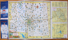
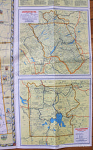
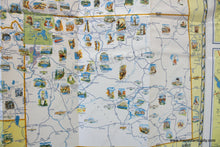
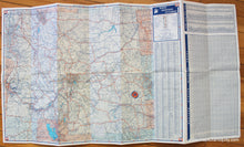
Antique printed color map of Idaho, Montana, and Wyoming featuring illustrations, published by Rand McNally for Union Oil Company in 1947. Illustrations feature a variety of natural monuments and notable places. National Parks are noted with maps of the parks included on the right side. Verso is a road map of the same area with a mileage chart, towns and cities index, and a radio guide. Measures approx. 18.75 x 21.5 inches.

Item Number: WES391