Genuine Antique Uncolored Map
1682
Maker: Stoopendaal.
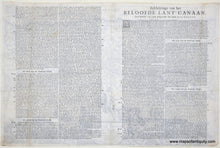
"The Promised Land of Canaan as walked by our Savior Jesus Christ, along with his Apostles"
Antique uncolored map of the Holy Land, by Daniel Stoopendaal, from a Staten Bible dated 1682. From the Dutch so-called ' Staten' bibles, published between 1637 and c. 1760, this map depicts the Holy Land, showing the geography as it appeared during the time of Jesus Christ. It features detailed illustrations of biblical scenes, including the birth of Jesus and the crucifixion. Very good restored condition with mild signs of age. This map has been cleaned, deacidified, and repaired. Approx. 11.75 x 18 inches to the neatline.
Genuine Antique Map from 1682
Item Number: MID213


