UNFRAMED MAPS should be ordered PRIOR TO Thursday, DECEMBER 19th for arrival by December 25th (December 13th deadline for Hawaii). We are PAST THE DEADLINE for orders with custom framing unless you will be picking up. Current hours: 10am to 5pm Monday through Saturday. 12pm to 5pm Sundays. IMPORTANT PLEASE NOTE: We have become aware that some of our photos have been stolen by other websites. Our maps are only available at our website www.mapsofantiquity.com or at our store!

Antique-map-United-States-America-Melish-Lavoisne-1820-Texas-Territories-Northwest-Westward-expansion-1820s-1800s-19th-century-Maps-of-Antiquity
  • Load image into Gallery viewer, Antique-map-United-States-America-Melish-Lavoisne-1820-Texas-Territories-Northwest-Westward-expansion-1820s-1800s-19th-century-Maps-of-Antiquity
  • Load image into Gallery viewer, Antique-map-United-States-America-Melish-Lavoisne-1820-Texas-Territories-Northwest-Westward-expansion-1820s-1800s-19th-century-Maps-of-Antiquity
  • Load image into Gallery viewer, Antique-map-United-States-America-Melish-Lavoisne-1820-Texas-Territories-Northwest-Westward-expansion-1820s-1800s-19th-century-Maps-of-Antiquity

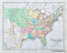
1821 - United States of America compiled from the latest & best authorities - Antique Map

Regular price
$995.00
Sale price
$995.00
Regular price
Sold out
Unit price
per 
Shipping calculated at checkout.

Item number: USA298
Genuine Antique Hand Colored Map

1821

Maker: Melish


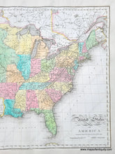
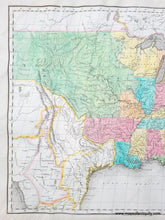
Antique hand colored map of the United States as it was in 1820, by Melish and published in Lavoisne's 1821 atlas. This map was engraved by B. Tanner and the atlas published by M. Carey & Son. The West is comprised of territories including the massive Missouri Territory, a strange Arkansas Territory, and the North West Territory. Texas is not yet part of the US and has very interesting borders. Much of the west is owned by Mexico. At this time there were no railroads or trains and all travel was done by carriage or boat.  A wonderful early map that clearly shows a moment in the formation of the country. Very good restored condition with some minor repaired tears and separations and a new margin. Approx. 17 x 21.25 inches to the nealine.  ***Note: this item will require additional insurance above what is included with the shipping as calculated by our website- we will send an invoice for the additional cost before shipping***  


Item Number: USA298