Genuine-Antique-Wall-Map-Map-of-the-Town-of-Groton-Middlesex-County-Massachusetts-Caleb-Butler-1831-Maps-Of-Antiquity
  • Load image into Gallery viewer, Genuine-Antique-Wall-Map-Map-of-the-Town-of-Groton-Middlesex-County-Massachusetts-Caleb-Butler-1831-Maps-Of-Antiquity
  • Load image into Gallery viewer, Genuine-Antique-Wall-Map-Map-of-the-Town-of-Groton-Middlesex-County-Massachusetts-Caleb-Butler-1831-Maps-Of-Antiquity
  • Load image into Gallery viewer, Genuine-Antique-Wall-Map-Map-of-the-Town-of-Groton-Middlesex-County-Massachusetts-Caleb-Butler-1831-Maps-Of-Antiquity
  • Load image into Gallery viewer, Genuine-Antique-Wall-Map-Map-of-the-Town-of-Groton-Middlesex-County-Massachusetts-Caleb-Butler-1831-Maps-Of-Antiquity
  • Load image into Gallery viewer, Genuine-Antique-Wall-Map-Map-of-the-Town-of-Groton-Middlesex-County-Massachusetts-Caleb-Butler-1831-Maps-Of-Antiquity
  • Load image into Gallery viewer, Genuine-Antique-Wall-Map-Map-of-the-Town-of-Groton-Middlesex-County-Massachusetts-Caleb-Butler-1831-Maps-Of-Antiquity

1831 - A Map of the Town of Groton, Middlesex County, Massachusetts - Antique Map

Regular price
$2,100.00
Sale price
$2,100.00
Regular price
Sold out
Unit price
per 
Shipping calculated at checkout.

Item number: MAS2310
Genuine Antique Map

1831

Maker: Caleb Butler / Pendleton's Lithography


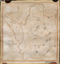
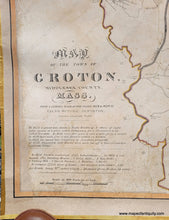
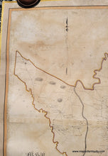
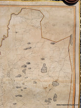
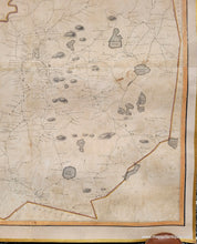
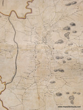
Antique wall map of Groton, MA, from surveys conducted by Caleb Butler in 1828 and 1829, printed by Pendleton's Lithography in 1831. One of the earliest town maps of Groton, this wall map is full of interesting details. It shows some topography, ponds, carriage roads, churches, mills, schools including Groton Academy, and houses. It includes the name of every property owner at the time. On the main roads are mile notations for the distance from the town hall/center of town. Overall a delightfully interesting early map of the town. Good to very good restored condition. This map has been archivally restored and backed on fabric with silk ribbon at edges. It retains various signs of age, including toning, minor stains, some loss of the paper surface, etc. The entire left side margin was lost has been filled in during the restoration process. Measures approx. 30 x 27.75 inches to the neatline of the map. 


Item Number: MAS2310