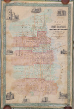
1850
Maker: Collins & Clark
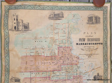
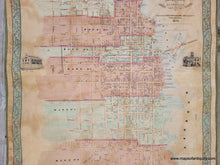
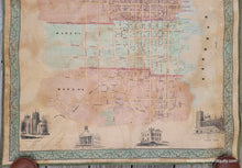
Antique hand-colored wall map of New Bedford, MA, from original surveys by J.C. Sidney, published by Collins & Clark, printed by Wagner & McGuigan, 1850. This scarce map is rarely available for sale and can generally only be found in the collections of Harvard and Princeton. It is colored by ward and includes street names, property owners of the time, the many wharves of this important whaling town, and illustrations of notable buildings, including City Hall, the Court House, the Customs House, Wamsutta Mills, and several churches. A sumptuous decorative border surrounds the map. Very good restored condition, with some signs of age. This map was cleaned, the varnish removed, deacidified, backed with cloth, and any damaged and missing areas repaired or filled in. New silk ribbon edging. No rods, but we do have extra rods and can attach them on request. Measures approx. 45 x 30 inches to the outer edge of the decorative border.
Item Number: MAS2247R


