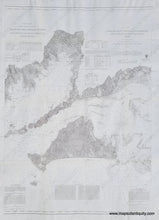
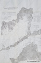
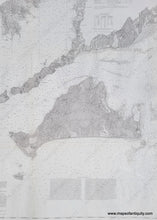
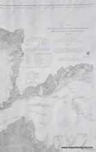
Uncolored antique sailing chart of Buzzard's Bay and Martha's Vineyard from 1860
  • Load image into Gallery viewer, Uncolored antique sailing chart of Buzzard's Bay and Martha's Vineyard from 1860
  • Load image into Gallery viewer, Uncolored antique sailing chart of Buzzard's Bay and Martha's Vineyard from 1860
  • Load image into Gallery viewer, Uncolored antique sailing chart of Buzzard's Bay and Martha's Vineyard from 1860
  • Load image into Gallery viewer, Uncolored antique sailing chart of Buzzard's Bay and Martha's Vineyard from 1860

1860 - Chart No. 13 From Muskeget Channel to Buzzard's Bay and Entrance to Vineyard Sound Mass. - Antique Report Chart

Regular price
$450.00
Sale price
$450.00
Regular price
Sold out
Unit price
per 
Shipping calculated at checkout.

Item number: MAS1672BW

Genuine Antique Coastal Chart

1860

Maker: US Coast Survey.


Antique Coast Survey Report Chart, part of a set of Coast Charts Nos. 11, 12 & 13, Coast of the United States, from Monomoy and Nantucket Shoals to Block Island. Uncolored chart of the south coast of Massachusetts from New Bedford in the west across Buzzards Bay and Vineyard Sound to Muskeget Channel just west of Nantucket, including very fine detailed map of Martha's Vineyard with topography, Elizabeth Islands, and of coastal towns such as Falmouth, Woods Hole and Osterville, all the way to Hyannis Light. With great detail and information on magnetic compass variations, soundings, lighthouses, and sea bottom material. Very good overall restored condition, cleaned and backed with light-weight paper. Slight waviness to the paper. Measures approx. 37 x 26.5 inches to the neatline. No neatline on sides as issued. 


Item Number: MAS1672BW