Antique-Hand-Colored-Map-Plymouth-Village-(MA)-**********-United-States-Massachusetts-1879-Walker-Maps-Of-Antiquity
1879 - Plymouth Village (MA) - Antique Map
  • Load image into Gallery viewer, Antique-Hand-Colored-Map-Plymouth-Village-(MA)-**********-United-States-Massachusetts-1879-Walker-Maps-Of-Antiquity
  • Load image into Gallery viewer, Antique-Hand-Colored-Map-Plymouth-Village-(MA)-**********-United-States-Massachusetts-1879-Walker-Maps-Of-Antiquity
  • Load image into Gallery viewer, 1879 - Plymouth Village (MA) - Antique Map

1879 - Plymouth Village (MA) - Antique Map

Regular price
$125.00
Sale price
$125.00
Regular price
$175.00
Sold out
Unit price
per 
Shipping calculated at checkout.

Item number: MAS1504B
Genuine Antique Hand Colored Map

1879

Maker: Walker.


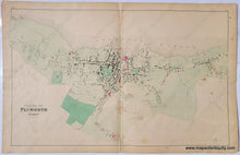
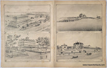
From the Atlas of Plymouth County, MA, 1879, by Walker, Village of Plymouth, showing property owners, named streets, schools, churches, railroad and depot, National and Soldier's Monuments, numerous mills and waterfront along Plymouth Harbor; versos display engravings of the Curtis and Keith estates, and of Plymouth's Clifford House and Samoset House.

Two map options: Better condition and Lesser Condition.

Better condition: Very good antique condition with some minor stains at tears at the edges of the paper, with overall mild toning and slightly darker toned along center fold.

Lesser condition: Fair to good overall antique condition, even toning, mild stains, repaired separations along fold at top and bottom. Priced as-is. Measures approx. 16 x 25.5 inches. 


Item Number: MAS1504B