1881
Maker: Mitchell.
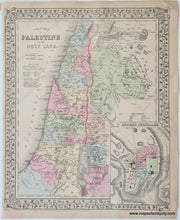
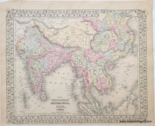
Antique hand-colored maps from Mitchell's 1881 New General Atlas. On one side is a map of Israel with an inset map of Modern Jerusalem, and on the other side is a map of part of Asia including India, Southeast Asia, and China. Shows railways, regional boundaries, cities, towns, water bodies, as well as land features. Decorative border. It appears this map was printed from an earlier plate because the year in the copyright note has been imperfectly amended. This page is in very good antique condition with minor overall toning. Paper is a bit fragile. Some small edge tears and folds. Page measures approximately 15 x 12 inches.
Item Number: MID197A


