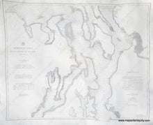
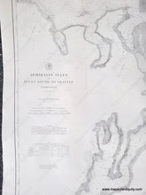
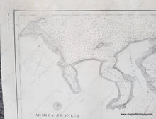
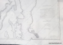
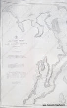
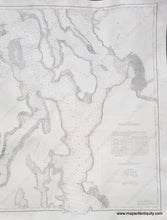
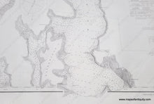
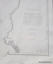
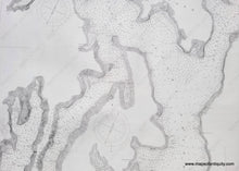
Impressive black and white sailing chart of part of Puget Sound with the vicinity around Seattle, Washington, from 1891. Dynamic image showing the coastline as it was in the late 1800s, before the major fill projects around Seattle.
1891 - Admiralty Inlet and Puget Sound to Seattle Washington - Antique Chart
  • Load image into Gallery viewer, Impressive black and white sailing chart of part of Puget Sound with the vicinity around Seattle, Washington, from 1891. Dynamic image showing the coastline as it was in the late 1800s, before the major fill projects around Seattle.
  • Load image into Gallery viewer, 1891 - Admiralty Inlet and Puget Sound to Seattle Washington - Antique Chart
  • Load image into Gallery viewer, 1891 - Admiralty Inlet and Puget Sound to Seattle Washington - Antique Chart
  • Load image into Gallery viewer, 1891 - Admiralty Inlet and Puget Sound to Seattle Washington - Antique Chart
  • Load image into Gallery viewer, 1891 - Admiralty Inlet and Puget Sound to Seattle Washington - Antique Chart
  • Load image into Gallery viewer, 1891 - Admiralty Inlet and Puget Sound to Seattle Washington - Antique Chart
  • Load image into Gallery viewer, 1891 - Admiralty Inlet and Puget Sound to Seattle Washington - Antique Chart
  • Load image into Gallery viewer, 1891 - Admiralty Inlet and Puget Sound to Seattle Washington - Antique Chart
  • Load image into Gallery viewer, 1891 - Admiralty Inlet and Puget Sound to Seattle Washington - Antique Chart
  • Load image into Gallery viewer, 1891 - Admiralty Inlet and Puget Sound to Seattle Washington - Antique Chart
  • Load image into Gallery viewer, 1891 - Admiralty Inlet and Puget Sound to Seattle Washington - Antique Chart

1891 - Admiralty Inlet and Puget Sound to Seattle Washington - Antique Chart

Regular price
$2,500.00
Sale price
$2,500.00
Regular price
Sold out
Unit price
per 
Shipping calculated at checkout.

Item number: NAU542

Genuine Antique Survey Chart

1891

Maker: US Coast & Geodetic Survey


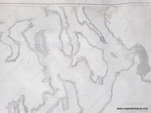
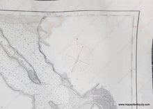
Antique chart of the Puget Sound with Seattle, published by the US Coast & Geodetic Survey in 1891. Includes Port Townsend, New Dungeness Bay, Port Gamble, Edmonds, Tulalip, and more. Seattle appears in the lower right. This map shows the area of Seattle around the beginning of the massive fill projects of the 1890s-1930s, which transformed the city. Seattle was incorporated as a town January 14, 1865. That charter was voided January 18, 1867, in response to questionable activities of the town's elected leaders. Seattle was re-incorporated December 2, 1869. What is labeled on the map as Duwamish Bay was largely filled in and built upon, and what was not filled in is now known as Elliot Bay. With soundings, topography, and many named bays, harbors, and points. Text discusses Tides, Buoys, Lights, Soundings, Abbreviations, and more. Good to very good restored condition with mild stain at top, repaired tears and some repaired paper loss at the edges. Lost areas have been filled in. Backed on canvas for stability. Some other small spots. Slight waviness from having been rolled in the past. Measures approx. 40.5" W x 32.5" H to the neatline. 


Item Number: NAU542