Genuine-Antique-Map-Brooklyn-NY-New-York-1900-Cram-Maps-Of-Antiquity
Genuine-Antique-Map-Brooklyn-NY-New-York-Baltimore-Maryland-1900-Cram-Maps-Of-Antiquity
  • Load image into Gallery viewer, Genuine-Antique-Map-Brooklyn-NY-New-York-1900-Cram-Maps-Of-Antiquity
  • Load image into Gallery viewer, Genuine-Antique-Map-Brooklyn-NY-New-York-Baltimore-Maryland-1900-Cram-Maps-Of-Antiquity

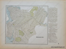
1900 - Brooklyn, NY - Antique Map

Regular price
$85.00
Sale price
$85.00
Regular price
Sold out
Unit price
per 
Shipping calculated at checkout.

Item number: TOW665a
Genuine Antique City Map

1900

Maker: Cram.


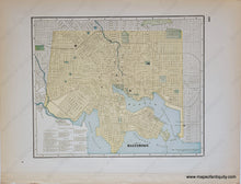
Antique double-sided printed color city plan, by Geo. Cram, circa 1900. Map of Brooklyn NY on one side and map of Baltimore MD on the reverse. Very good overall antique condition with toning at edges and some minor stains mostly in margins. Brooklyn map measures 10 x 11 inches to the neatline. Text on the right side lists elevated railroad stations and the various districts. Baltimore map measures approx. 10 x 12.5 inches


Item Number: TOW665a