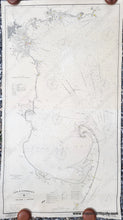
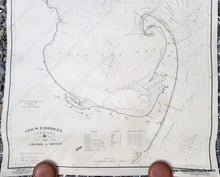
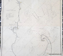
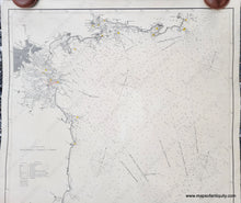
Antique nautical sailing chart showing Cape Cod to Gloucester, Massachusetts, with Plymouth, Boston, and Salem harbors, published by George W Eldridge in 1902. Stunning black-and-white graphic design with north oriented to the upper right. The lighthouses are indicated with small red dots and yellow beams.
1902 - Geo. W. Eldridge's Chart D, Massachusetts Bay and the Coast from Chatham to Gloucester - Antique Chart
  • Load image into Gallery viewer, Antique nautical sailing chart showing Cape Cod to Gloucester, Massachusetts, with Plymouth, Boston, and Salem harbors, published by George W Eldridge in 1902. Stunning black-and-white graphic design with north oriented to the upper right. The lighthouses are indicated with small red dots and yellow beams.
  • Load image into Gallery viewer, 1902 - Geo. W. Eldridge's Chart D, Massachusetts Bay and the Coast from Chatham to Gloucester - Antique Chart
  • Load image into Gallery viewer, 1902 - Geo. W. Eldridge's Chart D, Massachusetts Bay and the Coast from Chatham to Gloucester - Antique Chart
  • Load image into Gallery viewer, 1902 - Geo. W. Eldridge's Chart D, Massachusetts Bay and the Coast from Chatham to Gloucester - Antique Chart
  • Load image into Gallery viewer, 1902 - Geo. W. Eldridge's Chart D, Massachusetts Bay and the Coast from Chatham to Gloucester - Antique Chart

1902 - Geo. W. Eldridge's Chart D, Massachusetts Bay and the Coast from Chatham to Gloucester - Antique Chart

Regular price
$1,800.00
Sale price
$1,800.00
Regular price
Sold out
Unit price
per 
Shipping calculated at checkout.

Item number: NAU127R
Genuine Antique Nautical Chart

1901/1902

Maker: George W. Eldridge.


Antique black and white sailing chart by George Eldridge, published in 1901 and corrected to 1902. Shows Massachusetts Bay and Coast from Chatham to Boston. Includes Cape Cod, Plymouth, Boston Harbor, and Cape Ann. This chart was published before the Cape Cod Canal was opened, which meant that vessels needed to travel around Cape Cod safely to reach Boston from the south, making this an important chart to have onboard. Very good restored condition. This chart has been cleaned, deacidified, and backed with fabric. It retains some signs of age such as small wrinkles, repaired holes and tears.  Good dark, clear strike, 54.75 x 29.5 inches. **NOTE- because this map requires extra insurance for shipping, an additional charge will appear on your card after your original purchase. If you would like to know what that charge will be, please contact us.**


Item Number: NAU127R