Winter hours: Tuesday - Saturday 10am to 5pm. Close Sundays and Mondays until May. We appreciate your business!

Genuine-Antique-Topographic-map-Patuxent-Quadrangle-Maryland-MD-Washington-DC-Antique-Topo-Map-Antique-Geological-&-Topographical-Maps-Vermont-1906-USGS-Maps-Of-Antiquity-1800s-19th-century
  • Load image into Gallery viewer, Genuine-Antique-Topographic-map-Patuxent-Quadrangle-Maryland-MD-Washington-DC-Antique-Topo-Map-Antique-Geological-&-Topographical-Maps-Vermont-1906-USGS-Maps-Of-Antiquity-1800s-19th-century
  • Load image into Gallery viewer, Genuine-Antique-Topographic-map-Patuxent-Quadrangle-Maryland-MD-Washington-DC-Antique-Topo-Map-Antique-Geological-&-Topographical-Maps-Vermont-1906-USGS-Maps-Of-Antiquity-1800s-19th-century

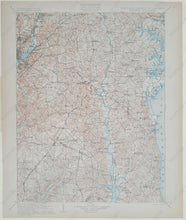
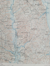
1906 - Patuxent Quadrangle Maryland - Antique Map

Regular price
$55.00
Sale price
$55.00
Regular price
Sold out
Unit price
per 
Shipping calculated at checkout.

Item number: TOP117
Genuine Antique Topographic map

1906

Maker: USGS.


Antique topographic map of part of Maryland on Chesapeake Bay, including parts of Charles County, Prince Georges County, Calvert County, Anne Arundel County, and the District of Columbia. Part of Washington DC is visible on the left side. Very good condition with minor signs of age. Sheet size is 20"h x 16.75"w.


Item Number: TOP117