1907
Maker: Boston & Northern and Old Colony Street Railway Companies
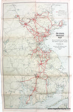
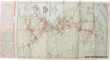
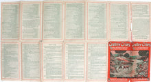
Antique printed color trolley route map showing Boston & Northern and Old Colony Street Railway Companies' Systems and Connecting Lines, Issued by the Passenger Dept, copyright 1907 by Boston & Northern and Old Colony Street Railway Companies. Includes routes from Newport to Nantasket and Boston to Cape Ann and Nashua. Fair condition with seam separations and some mild stains. The text at the top could be folded behind the map for framing. Paper is fragile. Measures approx. 23.25 x 14.25 inches to the neatline. Priced as-is.
Item Number: MAS2232


