Current hours: 10am to 5pm Tuesday through Saturday. We are closed Sundays and Mondays for the Winter. Proud to be a SMALL, LOCAL, CAPE COD BUSINESS! Maps of Antiquity is in its 38th year! Our maps are only available at our website www.mapsofantiquity.com or at our store!

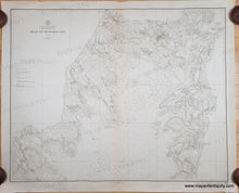
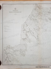
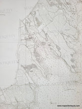
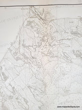
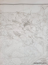
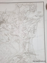
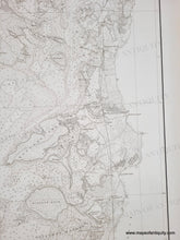
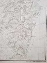
Black and white chart showing Buzzards Bay with the beginnings of the Cape Cod Canal. Includes some topographic details along the coast.
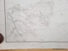
Mattapoisett Massachusetts detail. Black and white chart showing Buzzards Bay with the beginnings of the Cape Cod Canal. Includes some topographic details along the coast.
Marion Massachusetts detail. Black and white chart showing Buzzards Bay with the beginnings of the Cape Cod Canal. Includes some topographic details along the coast.
Wareham Massachusetts detail. Black and white chart showing Buzzards Bay with the beginnings of the Cape Cod Canal. Includes some topographic details along the coast.
Onset, Massachusetts detail. Black and white chart showing Buzzards Bay with the beginnings of the Cape Cod Canal. Includes some topographic details along the coast.
Black and white chart showing Buzzards Bay with the beginnings of the Cape Cod Canal. Includes some topographic details along the coast.
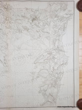
Falmouth Islands detail. Black and white chart showing Buzzards Bay with the beginnings of the Cape Cod Canal. Includes some topographic details along the coast.
  • Load image into Gallery viewer, Black and white chart showing Buzzards Bay with the beginnings of the Cape Cod Canal. Includes some topographic details along the coast.
  • Load image into Gallery viewer, Black and white chart showing Buzzards Bay with the beginnings of the Cape Cod Canal. Includes some topographic details along the coast.
  • Load image into Gallery viewer, Black and white chart showing Buzzards Bay with the beginnings of the Cape Cod Canal. Includes some topographic details along the coast.
  • Load image into Gallery viewer, Mattapoisett Massachusetts detail. Black and white chart showing Buzzards Bay with the beginnings of the Cape Cod Canal. Includes some topographic details along the coast.
  • Load image into Gallery viewer, Marion Massachusetts detail. Black and white chart showing Buzzards Bay with the beginnings of the Cape Cod Canal. Includes some topographic details along the coast.
  • Load image into Gallery viewer, Wareham Massachusetts detail. Black and white chart showing Buzzards Bay with the beginnings of the Cape Cod Canal. Includes some topographic details along the coast.
  • Load image into Gallery viewer, Onset, Massachusetts detail. Black and white chart showing Buzzards Bay with the beginnings of the Cape Cod Canal. Includes some topographic details along the coast.
  • Load image into Gallery viewer, Black and white chart showing Buzzards Bay with the beginnings of the Cape Cod Canal. Includes some topographic details along the coast.
  • Load image into Gallery viewer, Falmouth Islands detail. Black and white chart showing Buzzards Bay with the beginnings of the Cape Cod Canal. Includes some topographic details along the coast.
  • Load image into Gallery viewer, Falmouth Islands detail. Black and white chart showing Buzzards Bay with the beginnings of the Cape Cod Canal. Includes some topographic details along the coast.

1912 - Head of Buzzards Bay, Massachusetts - Antique Chart

Regular price
$450.00
Sale price
$450.00
Regular price
Sold out
Unit price
per 
Shipping calculated at checkout.

Item number: NAU545A

Genuine Antique Chart

1912

Maker: US Coast & Geodetic Survey


Antique chart of the head of Buzzards Bay published in 1912 by the US Coast and Geodetic Survey (USCGS). Includes Falmouth, Wareham, Marion, Mattapoisett, Buzzards Bay, Scraggy Neck, etc. This chart was published during the creation of the Cape Cod Canal (it opened in 1914) and you can see the path ships were told to take to approach the Canal and the narrow first iteration of the Canal, which many mariners avoided because the convenience did not outweigh the danger. The Cape Cod Canal was taken over by the US government by presidential proclamation after a German U-boat shelled a tugboat in Orleans in 1918. In 1928, the government purchased the canal as a free public waterway, and between 1935 and 1940 the canal's width and depth were increased. As a result, it became the widest sea-level canal of its time. With water depths and navigational information. Very good antique condition with a vertical fold at center, some mild toning, some tiny spots/foxing, and minor wear at the paper edges. Measures approx. 32.5 x 40.5 inches to the neatline.

Genuine Antique Chart from 1912

Item Number: NAU545A