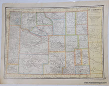
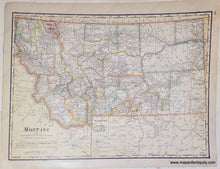
Genuine Antique Map
1916
Maker: Cram
Antique printed color map published in Cram's 1916 Universal Atlas. Double-sided map: one side is Wyoming, the other is Montana. Shows early counties, cities, towns, railroads, etc. National Parks are noted, including Yellowstone and Glacier. Also indicates Reservation lands. Very good antique condition with mild toning, some slight wrinkling of the antique paper. Each map measures approx. 10.25 x 14 inches to the neatline.
Genuine Antique Map from 1916
Item Number: WES543


