CLOSED ON JULY 4TH! Current hours: 10am to 5pm Monday through Saturday and 12-5 on Sundays. Proud to be a SMALL, LOCAL, CAPE COD BUSINESS! Maps of Antiquity is in its 38th year! Our maps are only available at our website www.mapsofantiquity.com or at our store!

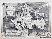
black and white map with illustrations of Shelter Island and a map showing routes to Shelter Island from Long Island. Antique-Map-of-Shelter-Island-Long-Island-New-York-Paul-Laune-Pictorial-1934-1930s-20th-Century-Pictorial-Maps-of-Antiquity
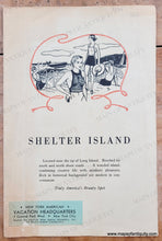
Back side of map- advertisement for Shelter Island showing people enjoying the water.
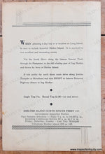
Back side of map- advertisement for Shelter Island with ferry info.
  • Load image into Gallery viewer, black and white map with illustrations of Shelter Island and a map showing routes to Shelter Island from Long Island. Antique-Map-of-Shelter-Island-Long-Island-New-York-Paul-Laune-Pictorial-1934-1930s-20th-Century-Pictorial-Maps-of-Antiquity
  • Load image into Gallery viewer, Back side of map- advertisement for Shelter Island showing people enjoying the water.
  • Load image into Gallery viewer, Back side of map- advertisement for Shelter Island with ferry info.

1934 - A Map of Shelter Island - Antique Map

Regular price
$350.00
Sale price
$350.00
Regular price
Sold out
Unit price
per 
Shipping calculated at checkout.

Item number: NYO761BW

Genuine Antique Map

1934

Maker: Paul Laune.


Antique pictorial map of Shelter Island, New York, by Paul Laune, 1934. Includes an inset map of Long Island which shows the routes to Shelter Island. Features illustrations of various activities on the island, as well as some historical details and events. Map shows the names of major roads and various points of interest (Quaker Cemetery, Town Hall, the Old Landing, Yacht Club, etc.) This small, collectible map is rarely seen on the market. Very good overall antique condition with fold as issued and very minor wear at the outer edges. Measures approx. 9.5 x 12.5 inches to the paper edges.

Genuine Antique Map from 1934

Item Number: NYO761BW