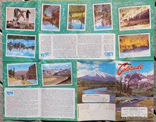
Colorful map of Colorado with illustrations throughout, yellow border, red highways
Tourism pamphlet about Colorado with photo and text
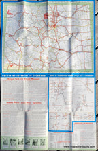
tourism pamphlet for COlorado with road map
  • Load image into Gallery viewer, Colorful map of Colorado with illustrations throughout, yellow border, red highways
  • Load image into Gallery viewer, Tourism pamphlet about Colorado with photo and text
  • Load image into Gallery viewer, tourism pamphlet for COlorado with road map

1947 - Colorful Colorado - Antique Pictorial Map

Regular price
$125.00
Sale price
$125.00
Regular price
Sold out
Unit price
per 
Shipping calculated at checkout.

Item number: WES245A
Genuine Antique Pictorial Map

1947

Maker: A.B. Hirschfeld Press


Antique printed-color pictorial map of Colorado featuring vignettes of many recognizable things and places that the state is known for. On verso is a map of the state's highway system. This map is part of a travel brochure and includes information about points of interest and photos. Very good condition with bright original color and folds as issued. Approx. 17 x 22 inches to the edges of the yellow printed area. Total paper size is 22 x 34 inches.


Item Number: WES245A