1955
Maker: Ernest Dudley Chase
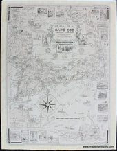
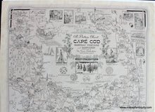
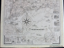
Charming, illustrated antique pictorial map of Cape Cod, Martha's Vineyard and Nantucket, and the mainland from Wareham to Duxbury, Massachusetts, by Ernest Dudley Chase, published by Trina Publishers, 1949. There were several versions of this map published, with later versions noting the map was "designed and drawn by Clara K. Chase," and the last versions (after 1960) include "President Kennedy's Summer Home." It includes town and village names, sixteen inset vignettes of historic sites and tourist attractions, many amusing and informative notes, cartouche surrounded by pine branches, fish scales and sea pickle, with a compass rose and rope border. Highly collectible and much desired among collectors. Good condition, extremely faded, with almost none of the original color. Minor signs of age at the paper edges including wrinkles, a few minor stains, and some small tears near Muskeget Island (archivally repaired). Paper is fragile. Measures approx. 28.75 x 22 inches to the paper edges. Could be hand colored by our professional colorist for an additional cost.
Item Number: MAS1686A


