Current hours: 10am to 5pm Monday through Saturday. 12pm to 5pm Sundays. IMPORTANT PLEASE NOTE: We have become aware that some of our photos have been stolen by other websites. Our maps are only available at our website www.mapsofantiquity.com or at our store!

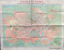
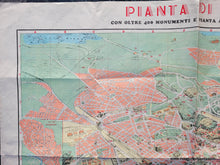
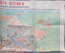
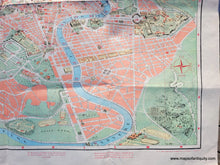
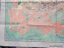
Colorful 1950s map of Rome showing some buildings as illustrations. Includes streets, points of interest, the River Tiber. With folds as issued.
  • Load image into Gallery viewer, Colorful 1950s map of Rome showing some buildings as illustrations. Includes streets, points of interest, the River Tiber. With folds as issued.
  • Load image into Gallery viewer, Colorful 1950s map of Rome showing some buildings as illustrations. Includes streets, points of interest, the River Tiber. With folds as issued.
  • Load image into Gallery viewer, Colorful 1950s map of Rome showing some buildings as illustrations. Includes streets, points of interest, the River Tiber. With folds as issued.
  • Load image into Gallery viewer, Colorful 1950s map of Rome showing some buildings as illustrations. Includes streets, points of interest, the River Tiber. With folds as issued.
  • Load image into Gallery viewer, Colorful 1950s map of Rome showing some buildings as illustrations. Includes streets, points of interest, the River Tiber. With folds as issued.

1950s - Rome, Italy - Pianta di Roma con oltre 400 Monumenti e Pianta Autofilotranviaria - Vintage Map

Regular price
$95.00
Sale price
$95.00
Regular price
Sold out
Unit price
per 
Shipping calculated at checkout.

Item number: TOW721
Vintage Pictorial Map

c. 1950s

Maker: Panetto & Petrelli


Pictorial map of Rome edited by Mauro Gigli, and published by Panetto & Petrelli, c. 1950s. This large and richly detailed map of Rome features illustrated images of about 400 notable monuments throughout the city. Each monument is numbered to correspond with a list on the back, as well as a street map on the back. Includes the Vatican, the Colloseum, panoramic viewpoints, Trevi Fountain, temples, museums, libraries, parks, thermal baths, and much more, each carefully rendered in detail.

North is oriented to the bottom of the map. Inset map at left shows the Citta Giardino (In its original form, the Garden City survived for about thirty years. Around the 1950s, with the great building boom and the construction of the Grande Raccordo Anulare, the image of a small garden city "was replaced by that of a denser and more compact district made up mainly of blocks of flats").

This map was published as a folding tourist map. Title translates to "Map of Rome with over 400 monuments and bus and tram map." Overall very good condition with some mild wear along the fold lines and tiny separations at the fold intersections. Measures approx. 23 x 31.5 inches to the neatline and 27.5 x 35 inches to the paper edges.


Item Number: TOW721