Current hours: 10am to 5pm Monday through Saturday. Closed on Sundays. PLEASE NOTE: Our maps are only available at our website www.mapsofantiquity.com or at our store!

Modern-Printed-Map-A-Geographic-Portrait-of-Martha's-Vineyard-Massachusetts-US-Massachusetts-Cape-Cod-and-Islands-1985-Dana-Gaines-Maps-Of-Antiquity
  • Load image into Gallery viewer, Modern-Printed-Map-A-Geographic-Portrait-of-Martha's-Vineyard-Massachusetts-US-Massachusetts-Cape-Cod-and-Islands-1985-Dana-Gaines-Maps-Of-Antiquity
  • Load image into Gallery viewer, Modern-Printed-Map-A-Geographic-Portrait-of-Martha's-Vineyard-Massachusetts-US-Massachusetts-Cape-Cod-and-Islands-1985-Dana-Gaines-Maps-Of-Antiquity

A Geographic Portrait of Martha's Vineyard Massachusetts - Modern

Regular price
$25.00
Sale price
$25.00
Regular price
Sold out
Unit price
per 
Shipping calculated at checkout.

Item number: MAS391BW
Modern Printed Map

1985

Maker: Dana Gaines


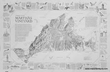
Printed map of  Martha's Vineyard done in 1985 by Dana Gaines, showing landforms, roads and towns, with geologic and historical information, as well as information on wildlife and many major points of interest. Paper measures approx. 20 x  30 inches. (Also available Dry Mounted and Hand Colored for $185.00... in-store pick up strongly recommended for dry mounted items).


Item Number: MAS391BW