1961
Maker: Courtland Smith.
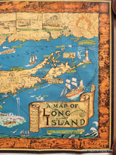
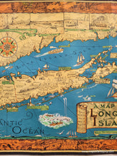
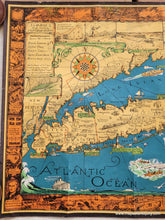
Antique re-issue of a 1933 pictorial map of Long Island, drawn by Courtland Smith from data compiled by Richard Foster, published by the Billboard Barn. This map was originally published in 1933 and re-issued by the company in 1961. Includes Brooklyn and Queens, the Hamptons, Montauk, and more. Landmarks such as Montauk Lighthouse, the beach at Southampton, and the Fire Island Light are depicted as illustrations. Additional delightful illustrations populate the Atlantic Ocean and Long Island Sound. The border is filled at the top with underwater scenes; on the sides with famous sites such as Birthplace of John Howard Payne, East Hampton, and Jones Beach; and with historical events, such as the settlement of Brooklyn and building of Brooklyn Bridge. The lower left of the border shows a scene of potato farming with the simple caption "Potatoes". The key indicates radio stations, state parks, ferry lines, small light houses, and mainland. Vivid color on heavy paper. Good to very good condition with some minor wear at the paper edges, some wrinkles, and vertical creases. Measures approx. 19.5 x 27 inches.
Item Number: NYO915


