Current hours: 10am to 5pm Monday through Saturday. 12pm to 5pm Sundays. IMPORTANT PLEASE NOTE: We have become aware that some of our photos have been stolen by other websites. Our maps are only available at our website www.mapsofantiquity.com or at our store!

Reproduction-Antique-Map-Southack-New-York-Long-Island-Cape-Cod-Boston-1710-1890
A Portion of a Map of New England, or the so-called Southack Map, Reproduction
  • Load image into Gallery viewer, Reproduction-Antique-Map-Southack-New-York-Long-Island-Cape-Cod-Boston-1710-1890
  • Load image into Gallery viewer, A Portion of a Map of New England, or the so-called Southack Map, Reproduction
  • Load image into Gallery viewer, A Portion of a Map of New England, or the so-called Southack Map, Reproduction

A Portion of a Map of New England, or the so-called Southack Map, Reproduction

Regular price
$150.00
Sale price
$150.00
Regular price
Sold out
Unit price
per 
Shipping calculated at checkout.

Item number: REP362HC

Reproduction

1890

Maker: Reproduction.


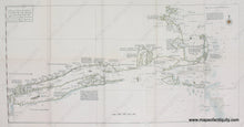
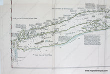
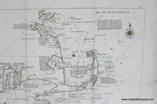
High quality, hand colored, giclee reproduction of an antique black and white map showing the coast line from New York City to Boston with water depths and navigation information. This is a modern reproduction of a 19th century map. The 19th century map was a recreation produced by the US Government in 1890 of a map that was originally produced in 1734 by Cyprian Southack. Shows Manhattan, Long Island, Providence Plantation, Nantucket, Martha's Vineyard, Cape Cod (including the break in Orleans which was navigable by boat), Plymouth, and Boston. It was copied in 1887 and this map was published in 1890 folded into the US Coast and Geodetic Survey Report book. approx. 18 x 35.5 inches to the neatline with about 2 inches of margin. Paper may be larger but can be trimmed as needed.


Item Number: REP362HC