Genuine Antique Map
1718 circa
Maker: Delisle
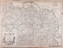
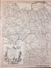
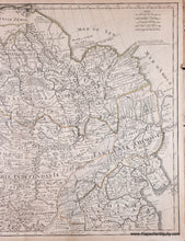
Antique map of Tartary or Northern Asia, by Guillaume Delisle, c. 1718. This map shows Siberia, Mongolia, Korea, Tibet, Bhutan, China, and as far west as the Black Sea and Moscow, and as far south as India. This map was published in several states- this state includes "Premier Geo. du Roi" added in the cartouche. Fascinating early geography that includes roads, cities, rivers, mountains and forests shown pictorially, and some speculative geography in the far north. Highly decorative cartouche. Fair to good antique condition, this map was mounted to a board. It has some mild toning, some slight spots, stains, and surface soil including a horizontal line of darkening at the center. Overall it looks quite good and should frame nicely. Measures approx. 19.25 x 25.25 to the neatline. Priced as-is.
Genuine Antique Map from 1718 circa
Item Number: ASI560


