c. 1890
Maker: Cram.
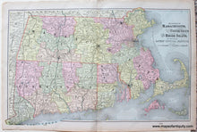
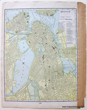
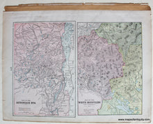
Antique printed color centerfold map of Massachusetts, Connecticut, and Rhode Island (Recto). Full, printed color. On the back of this map are two other maps: A map of New Hampshire and Vermont; and a map of the city of Boston (includes steam roads and horse roads.) Good to very good condition with some slight toning at the edges, some mild spots and stains, as well as some stray spots of printed color. By Cram, in The Standard Atlas and Gazetteer of The World, c. 1890. Recto: Approximately 12.25" x 20.25" to the neatline. Recto Map extends past the neatline towards the right of the top line and the left of the bottom. Verso: Adirondack Mts- approximately 9.25" x 6" to the neatline, White Mountains- approximately 8.75" x 6". Verso: Boston Map- Approximately 12.5" x 9.75" to the neatline.
Item Number: NEW105


