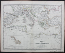
Antique-Map-Keith-Johnston-1880-1880s-1800s-Late-19th-Century-Basin-of-the-Mediterranean-Europe-Maltese-Islands-Maps-of-Antiquity
1880 - Basin of the Mediterranean - Antique Map
  • Load image into Gallery viewer, Antique-Map-Keith-Johnston-1880-1880s-1800s-Late-19th-Century-Basin-of-the-Mediterranean-Europe-Maltese-Islands-Maps-of-Antiquity
  • Load image into Gallery viewer, 1880 - Basin of the Mediterranean - Antique Map

1880 - Basin of the Mediterranean - Antique Map

Regular price
$75.00
Sale price
$75.00
Regular price
Sold out
Unit price
per 
Shipping calculated at checkout.

Item number: MED001
Genuine Antique Printed Color Map

1880

Maker: Johnston.

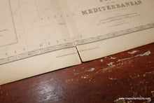
Antique printed color map of the Mediterranean Sea and surrounding countries, By Keith Johnston, 1880. Features an inset map of the Maltese Islands. Very good condition with center fold, as issued. Measures approximately 12.75" x 16.75" to the neatline.

Item Number: MED001