1894
Maker: Cram.
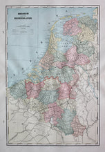
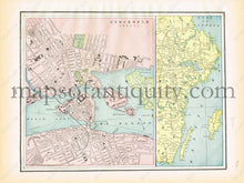
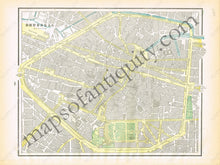
Antique printed color map of Belgium and The Netherlands (Recto, two-page map, pages 278 and 279). Verso: Page 277- Maps of the Gulf of Bothnia and Stockholm, Sweden. Page 280- Map of Brussels, Belgium. Very good condition with some slight toning at the edges of the pages. By Cram, in The Standard Atlas and Gazetteer of The World, 1894. Map of Belgium and The Netherlands Measurements: Approximately 15.75" x 10.5" to the neatline. Map of the Gulf of Bothnia Measurements: Approx. 9.25" x 4" to the neatline. Map of Stockholm, Sweden Measurements: Approx. 9.25" x 7.75" to the neatline. Map of Brussels, Belgium Measurements: Approx. 9.5" x 11.75" to the neatline. If you would like to purchase any of these maps separate from the others, please contact us.
Item Number: EUR1833


