Genuine Antique Lithograph Bird's Eye View, City View Map
c. 1920
Maker: The Union News Company.
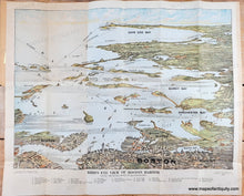
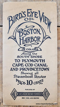
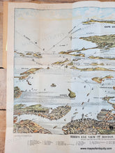
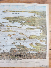
Antique lithograph bird's eye view looking south from Boston to Cape Cod, copyright 1920 by the Union News Co and engraved and printed by Federal Engraving Co. Along the South Shore to Provincetown, striking images of parts of Boston, Boston Harbor islands, the coast line to the Bay of Cape Cod, major points along the Boston Harbor shore and light houses are identified. Comes attached to original paper jacket, although the front of the jacket has separated and will be included. This original popular folded tourist map is in good antique condition, with some small tears at the paper edges, mild overall toning with a few areas of darker toning in the margins, and some tiny holes at the fold intersections. Approx. 14"h x 19"w to the image border and approx. 17 x 20.5 inches to the paper edges.
Genuine Antique Map from c. 1920
Item Number: MAS416


