Current hours: 10am to 5pm Tuesday through Saturday. We are closed Sundays and Mondays for the Winter. Proud to be a SMALL, LOCAL, CAPE COD BUSINESS! Maps of Antiquity is in its 38th year! Our maps are only available at our website www.mapsofantiquity.com or at our store!

Black-and-White-Antique-Illustration-Bird's-Eye-View-of-Philadelphia.-Towns-and-Cities-Northeast-1872-Harper's-Weekly-Maps-Of-Antiquity
1872 - Bird’s-Eye View Of Philadelphia. Antique Print Genuine Illustration
  • Load image into Gallery viewer, Black-and-White-Antique-Illustration-Bird's-Eye-View-of-Philadelphia.-Towns-and-Cities-Northeast-1872-Harper's-Weekly-Maps-Of-Antiquity
  • Load image into Gallery viewer, 1872 - Bird’s-Eye View Of Philadelphia. Antique Print Genuine Illustration
  • Load image into Gallery viewer, 1872 - Bird’s-Eye View Of Philadelphia. Antique Print Genuine Illustration
  • Load image into Gallery viewer, 1872 - Bird’s-Eye View Of Philadelphia. Antique Print Genuine Illustration

1872 - Bird's-Eye View of Philadelphia. - Antique Print

Regular price
$475.00
Sale price
$475.00
Regular price
Sold out
Unit price
per 
Shipping calculated at checkout.

Item number: TOW071
Genuine Antique Illustration

1872

Maker: Harper's Weekly.

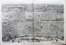
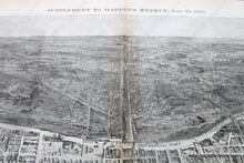
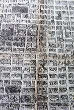
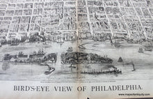
Black and white antique map and illustration from the Supplement to Harper's Weekly, June 15, 1872, showing a bird's eye view of Philadelphia, with beautiful detail, ships and boats in the harbor, etc. The Delware River is at bottom and the Schuylkill River is near top. Very good condition with light toning at edges, light toning at fold lines, a few minor spots, tape marks on side margins at folds, but with a mat these would not be apparent once framed. There is additional tape on the back of the map, we are unsure if it is archival. A page or two from Harper's Weekly is still attached to the upper left quadrant of the map on the back. With folds as issued. Map is very fragile, on light-weight paper that tears easily. Approx. 21 x 30 inches. If you are interested in this map and would like to discuss backing the map to make it less fragile, please contact us.

Item Number: TOW071