Antique-Hand-Colored-Map-Borough-of-Willimantic-Connecticut-Central-Village-East-Killingly-verso-Brooklyn-Windham-Center-Plainfield-Moosup-Dayville-Wauregan-South-Windham-Connecticut--1893-D.H.-Hurd-Maps-Of-Antiquity
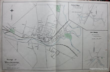
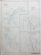
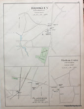
1893 - Borough of Willimantic, Connecticut, Central Village, East Killingly, verso Brooklyn, Windham Center, Plainfield, Moosup, Dayville, Wauregan, South Windham - Antique Map
  • Load image into Gallery viewer, Antique-Hand-Colored-Map-Borough-of-Willimantic-Connecticut-Central-Village-East-Killingly-verso-Brooklyn-Windham-Center-Plainfield-Moosup-Dayville-Wauregan-South-Windham-Connecticut--1893-D.H.-Hurd-Maps-Of-Antiquity
  • Load image into Gallery viewer, 1893 - Borough of Willimantic, Connecticut, Central Village, East Killingly, verso Brooklyn, Windham Center, Plainfield, Moosup, Dayville, Wauregan, South Windham - Antique Map
  • Load image into Gallery viewer, 1893 - Borough of Willimantic, Connecticut, Central Village, East Killingly, verso Brooklyn, Windham Center, Plainfield, Moosup, Dayville, Wauregan, South Windham - Antique Map

1893 - Borough of Willimantic, Connecticut, Central Village, East Killingly, verso Brooklyn, Windham Center, Plainfield, Moosup, Dayville, Wauregan, South Windham - Antique Map

Regular price
$85.00
Sale price
$85.00
Regular price
Sold out
Unit price
per 
Shipping calculated at checkout.

Item number: CON264
Genuine Antique Hand Colored Map

1893

Maker: D.H. Hurd.

Antique hand colored map of Willimantic, including streets, railroads, businesses, churches, schools, Fair Ground, Willimantic, Shetucket and Nutchaug Rivers. Very good condition, paper is toned, approx. 18 x 28 inches.

Item Number: CON264